GPS Tracking system

Empower your GPS tracking business with our secure and full-featured white label GPS monitoring platform


Free Demo

User Web Interface


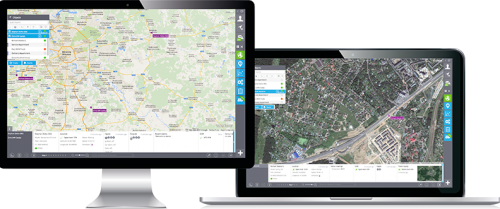
Smart and simple – this is what your users will say about your service. Intuitive web-interface embeds the latest technologies, looks great and works fast. And it meets the whole range of applications – from pet tracking to sophisticated enterprise solutions. Learn more

Mobile APPS
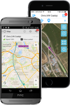


Wherever your users are, they get the agility and insight on any mobile device. iTrack gives free ‘X-GPS’ apps for all major mobile platforms so users can control their assets from anywhere and locate other people with GPS in their smartphones or tablets. Learn more

400+ Devices Supported
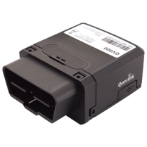


Our web based gps tracking system closely supports a huge range of GPS trackers, for all of them we offer fully automatic device activation. Select one of the brands from the list and click on the device image to see what device’s specific features are available. Learn more
Business-focused applications

iTrack helps business customers to manage fleets, increase mobile workforce productivity and improve goods dispatching – in multiple ways: comprehensive analytics, specific applications and integrations.

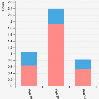
The overall analytics allows to focus on any aspect of mobile asset management. Reports with charts are provided in multiple formats, on request or by schedule. Background data pre-processing brings all the information fast and without affecting user productivity

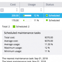
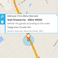
For specific business purposes there are special applications like ‘Tasks’ and ‘Fleet’. They allow to plan routes, manage tasks, measure team productivity, monitor driving behaviour, schedule vehicle maintenance, simplify costs accounting, and many more.

Developers can access all the data from third-party software with simple and powerful iTrack APIs, or by using direct ‘data forwarding’. For common use cases there is a set of ‘plugins’, that let you embed GPS tracking functionality right into web sites and social pages.

Maps and GIS


1. All maps at hand

Unlock the full set of web maps and satellite views available on the market. Offer your customers the most accurate maps enriched with geographic information system (GIS) that suit your region. Enable 3D and HD maps, monetize access to the most valuable maps and data sources, connect on-premise databases.

2. Custom maps and styles

Enable multiple cartographic styles designed to emphasize your brand’s identity or help to focus on particular geospatial data. Let corporate users visualize data they have in spreadsheets and databases, without allowing others to access it.

3. Multifaceted GIS to strengthen system functionality

An impressive set of maps go side by side with powerful GIS tools. Geocoding, routing, traffic, LBS / Cell ID, distance matrix and more – are widely used in notifications and reports, tasks planning and routes optimisation.

Editions & Pricing

You may choose any of 3 ways of using the iTrack GPS tracking system:

ServerMate

The standard way to becoming a service provider. All your data is stored on our server, that’s why you don’t need any extra resources to do business.

Cloud

The easiest way to start your business. All services will be run in a cloud. Simple to start, simple to conduct.

On-Premise

Good for big companies with system administration staff and special demands in the data storage.

Ready for the most innovative GPS tracking software?

Explore our products using demo access, or talk to our live sales team.

Try iTrack for free

Sign up and get your own GPS tracking platform instantly! A full-featured trial version will be available within 30 days and you'll be personally guided by one of our experts